All about the island of La Palma, in the Canaries.
Current Weather on La Palma
Friday, 9 October 2009
Lujan Crafts Shop
Traditional embroidery, Casa Lujan, Puntallana, La Palma
There's a shop of crafts from La Palma beside the museum at Casa Lujan in Puntallana. It sells things like traditional embroidery and ceramics. In the centre of the room, there's a traditional loom, although they didn't have any rugs for sale when I was there.
(Palmeran rugs are made with a linen warp, and rag weft. If you order one, you generally have to prepare the weft yourself. That means cutting the old clothes into strips 1 cm wide and sewing the ends together, and winding it into balls. You need patience.)
Traditional rug weaving, Casa Lujan, Puntallana, La Palma
They also have more modern arts and crafts, like this mobile by Rosa Vidal.
Open Monday-Saturday 10 am- 1 pm and 4 pm - 7 pm Google map here.
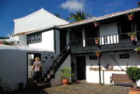
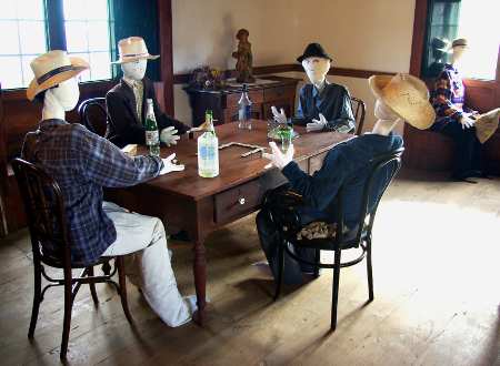
Casa Lujan is much more fun than you'd expect from the brochures, which describe it as an "ethnographic museum". But it's not a collection of stuff in dusty display cases. It's an 18th century house, with whole rooms restored to show how the comfortably-off lived between about 1920 and 1960. Even better, there are people "living" in the house. And rather than use shop mannequins, the "inhabitants" are giant rag dolls, called mayos because they traditionally make an appearance at Fiesta de la Cruz, in May. So one set of mayos are smoking and playing dominoes in the living room.
Living room of Casa Lujan, Puntallana
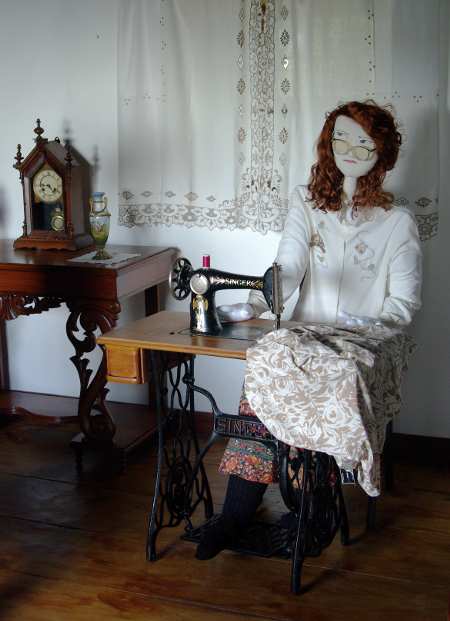
While this lady is busy sewing. (I used to have a reconditioned, treadle, Singer sewing machine much like this. I also used to have similar hair and glasses.)
Morning room Casa Lujan, Puntallana
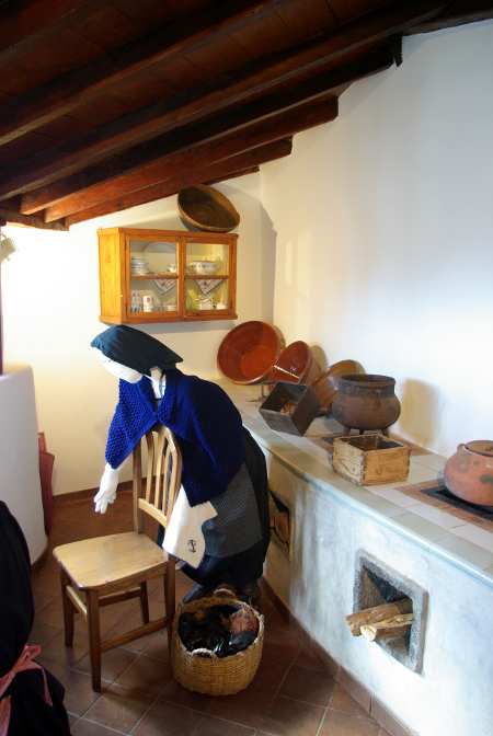
Meanwhile this servant is working in the kitchen
Kitchen of Casa Lujan, Puntallana
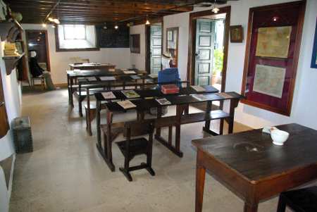
In 1919 the local council bought the house to use as a village school until about 1980, and the school room downstairs has been restored too.
The schoolroom, Casa Lujan, Puntallana
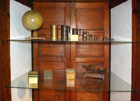
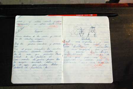
It's not just the furniture: they have posters on the walls explaining why you shouldn't go birds'-nesting, notebooks on the desks, and an old set of weights and measures. Set of measures in the school of Casa Lujan, Puntallana
Open Monday-Saturday 10 am- 1 pm and 4 pm - 7 pm Google map here. Admission is free, but there's a box for donations in the school room.
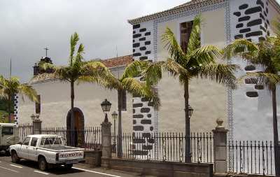
The exterior of the church of San Juan, Puntallana
As Palmeran churches go, the church of St. John the Baptist in Puntallana isn't all that old. The presbytery and the side chapels date from the 16th century, and the nave from the 1719. It was officially declared an Asset of Cultural Interest (rather like a listed building) in 1994.
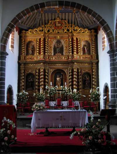
The main altar in the church of San Juan, Puntallana
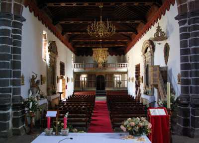
The inside of the church is beautiful.
The nave in the church of San Juan, Puntallana
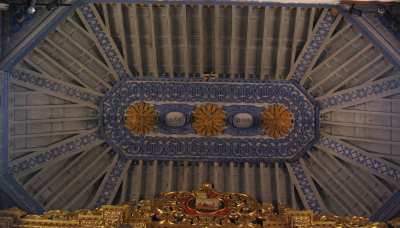
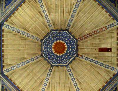
The oldest churches on La Palma were built by people who moved from what is now Andalusia, which has only recently been reconquered from the Arabs. The style is known as "Mudejar" which means "those allowed to stay." And this church has a beautiful mudejar ceiling. The ceiling in the Presbytery
The ceiling in the crossing
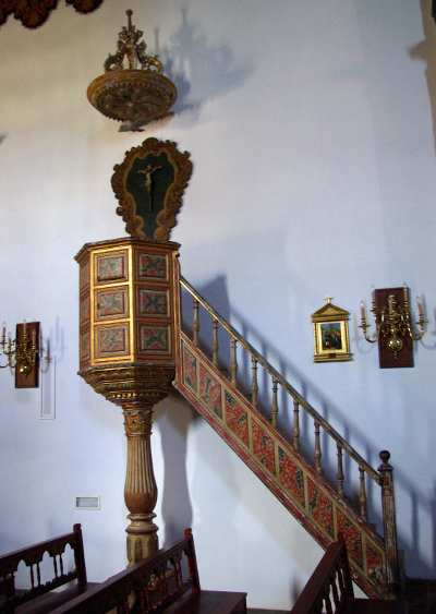
The pulpit
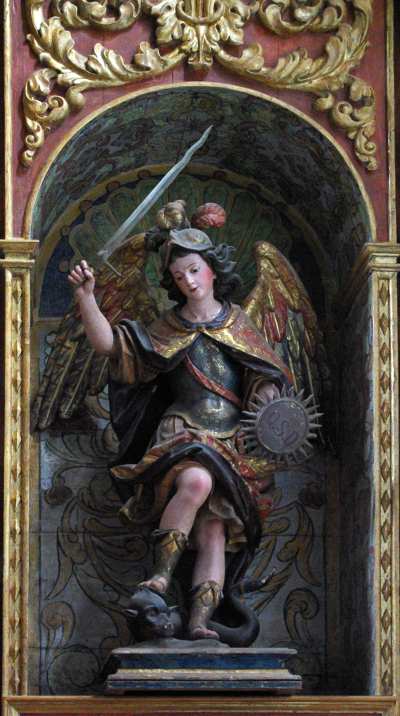
The church houses lots of statues. This one, of St. Michael the Archangel, was made by Benito de Hita y Castillo in the 18th century. You get a lot of statue of St. Michael on La Palma, because Alonso Fernández de Lugo, who led the conquest in 1493, saw St Michael as his ally in a crusade to bring the poor benighted natives into the Catholic church. (I can't help thinking they might have seen the whole thing rather differently, especially since the conquest involved killing or enslaving so many of them, and taking all the best land away from the rest.)
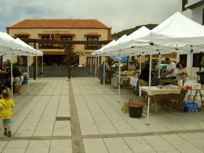
Puntallana now has a Farmer's market, too. They hold it on the 1st and 3rd Saturday of the month, from 10 am to 2 pm. It's smaller than the market at Puntagorda or Mazo, but it's plenty big enough to get fresh veg for a week's self-catering.
And it's right beside St John's church, which is beautiful and well worth a visit.
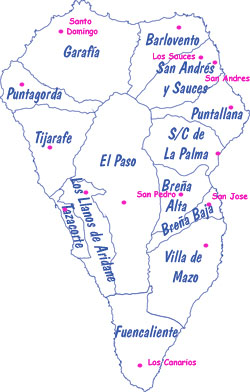
Tourists sometimes go nuts trying to find the village of Breña Baja, or Fuencaliente.
There's a really simple reason why they can't find them. They don't exist. Breña Baja and Fuencaliente are municipalities, and their town halls are in the villages of San Jose and Los Canarios, respectively. It like driving all over the south east of England, looking for the town of Sussex.
The map shows the 14 municipalities (in blue) , with their administrative seats (in pink). Where there's no name in pink, the municipalities are named after their chief villages, which makes things simpler. Just to keep things interesting, one, San Andrés y Sauces, is named after the two biggest villages. The town hall is in Los Sauces, which is much bigger and on the main road.
There's an alternative kind of accommodation aside from the obvious hotels and pensions on La Palma, and that's casas rurales - country houses. As the name suggests, these are houses for rent in the countryside. It's self-catering accommodation, which is, of course, very flexible, and tends to suit walkers. The local government has a registration scheme, and they have a reputation for being demanding, which is good news for tourists. They're mostly very comfortable, and some have swimming pools. Since they're in the countryside, they're usually in very peaceful surroundings. The downside of that is that you probably need a hire car to go anywhere else. (Although some walking tours come complete with transport).
The photos are of the cheapest casa rural I know of, Casa Maria Cruz, in Puntallana. It was built as a family home in the beginning of the 19th century and has just been renovated to include 21st century comforts.
Prices vary from 50€ a day for two people to 70€ a day for four (babies free), minimum stay three days. This includes cleaning before and after your stay. More information at: http://es.geocities.com/casamariacruz/index.htm
The owners only speak Spanish. If you want to book in English, email me: There's information on other country houses at: http://www.islabonita.es/
The feast of San Juan (St. John the Baptist) is June 24th.
Many people light bonfires on St John's Eve. In the days before municipal rubbish collection, it was a practical way of having a clear out. But in Puntallana, there is a long-held folk belief that the bonfires keep away witches. Jumping over the fire is supposed to protect you from disease and the Evil Eye. It's also a great night for fortune telling, using earth, air, fire and water.
I'm sure hte people celebrating would insist that this is a Catholic festival, and nothing at all to do with the Wiccan Midsummer celebrations, which also feature bonfires.
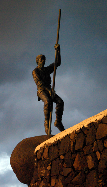
A long time ago, a young goatherd in Puntallana fell in love. Nothing unusual about that of course, especially since the girl was very beautiful.
The trouble was that she didn't feel the same way. He was tall, handsome and athletic, but she hoped to marry someone richer. After all, a goatherd's wife worked fourteen hours a day and went hungry in the bad years.
But he wouldn't take "No," for an answer.
In the end she got so tired of his pestering that she said she'd marry him if he performed an impossible task.
Because the Palmeran Terrain is so steep and rough, the goatherds followed their flocks with the help of a long wooden pole. In fact, the pre-hispanic Awara used much the same technique and some shepherds and goatherds still do, although it's more often a local sport these days. Some of the leaps they make are spectacular.
So the girl told the goatherd that she'd marry him if he made three semi-circular leaps out over the edge of the cliff at La Galga. This was a very difficult technique, in a very dangerous place.
To her astonishment and dismay, he agreed!
The agreed day arrived, and of course at least half the village went along to watch.
"In the name of Jesus!" cried the young man, and swung out over the void.
Amazingly, he landed safely on firm ground, to everyone's relief.
"In the name of the Virgin!" he cried, and swung out again.
Again he landed safely.
"And in the name of my beloved!" he cried, and swung out for the third time.
Some say he was simply tired after the first two leaps. Some say that Heaven was offended that he put a rather vain young woman on the same standing as Jesus and the Blessed Virgin. Regardless, as he swung back towards safety, he missed his footing and dropped to his death on the rocks far below.
They also say that the girl went mad with grief and never married at all.
Today a statue marks the site of the tragedy. Take the road north from Santa Cruz, towards Los Sauces, and turn off at the village of La Galga, following the sign for San Bartolome. There are two viewpoints. The lower one, beside the church, has a fantastic view of a bridge over a ravine. But if you carry on the top of the mountain, you get a view of all Puntallana, plus the statue.
And here's a short video of the technique for getting down a steep hill, using the pole.
You see a lot of flags on La Palma. Most English visitors will recognise the flags of Spain and the European Union.
But the Canary Islands are an autonomous region within Spain, and they have their own flag too. You see it a lot, especially around May 30th, which is Canary Day.
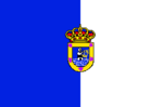
And then each island has its own flag. Here's the flag of La Palma:
And as if that weren't enough, La Palma has 14 municipalities, of which twelve have their own flag.
Santa Cruz
Breña Baja
Los Llanos
El Paso
Barlovento
Breña Alta
Garafía
Mazo
Tijarafe
Puntagorda
Puntallana
Tazacorte
(The other two municipalities are San Andres y Sauces and Fuencaliente)
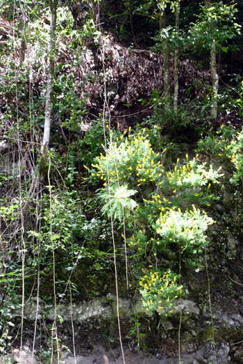
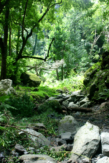
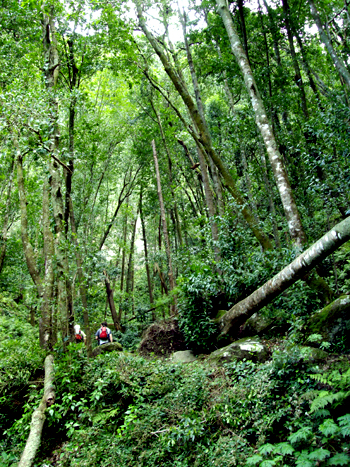
Cubo de la Galga is a very pretty walk along the bottom of the Galga ravine, between Puntallana and Los Sauces. By Palmeran standards, it's an easy walk.
"Walk! La Palma" is a good book, but the bit about the bottom end of the walk at Cubo de la Galga is out of date already. The Island Government (the Cabildo) have been busy.
There is now a car park at the beginning of the walk, on the road at km 16. You're unlikely to get lost for the first kilometre or so, because the path's actually asphalted, never mind signposted. It's a matter of taste, but this part was a bit too tamed for my taste, and I was glad when the asphalt stopped. In fact the path is currently so smooth you could actually walk for a couple of kilometers in stilettos, if stilettos are your thing. (I bought a pair of stilettos just before I came to La Palma. I've used them so little that seventeen years later, they still don't even need heeling.)
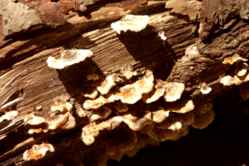
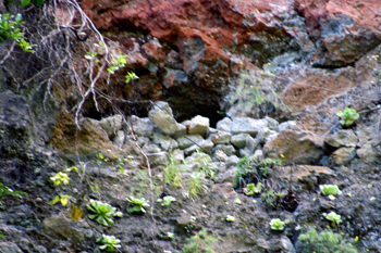
There are caves in the ravine walls. This one has a wall built across the mouth. at the time we wondered whether people had lived there at one time. Now I wonder whether it mightn't be the "windows" in the water channel, the Canal de Estado.
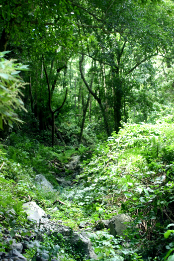
The book is absolutely right that the place would be famous if it weren't so close to Los Tilos. The path criss-crosses the stream bed (a trickle in April) and the ravine walls and trees tower over you.
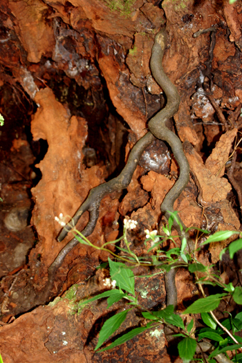
This means that the roots are at eye-level.
When the signpost seemed to indicate that it was time to turn back, we carried on a little, up a much rougher path.
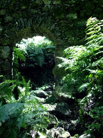
The path went under a little aqueduct.
Just above there is a flattish space, where we stopped to eat our sandwiches. Above that, the path divides. According to Charles Davis, you can make your way back to the road by another route, but we weren't sure of the way and I had to get back for the babysitter. So I can't tell you whether there are still fallen trees over the track.
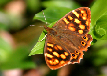
Throughout the walk, there were lots of butterflies, mostly sitting still until the camera focused, and then fluttering off. But I got lucky eventually. This one is common in the western Canaries, but lives nowhere else. Maculada de Canarias butterfly, Pararge xiphioides

 Traditional embroidery, Casa Lujan, Puntallana, La Palma
 Del.icio.us
 Digg
Digg
 Reddit
 Facebook
 Furl It
 Newsvine